
 English


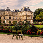
Fort Rhijnauwen, New Dutch LINE. Unknown Author. WIKIMEDIA.
Top 10 Astonishing Facts about New Dutch Water Line
The Dutch water line was a series of water-based defences. It was conceived by Maurice of Nassau in the early 17th century. Later, it was realised by his half-brother Frederick Henry.
The waterline has 45 forts,6 fortresses, hundreds of casemates, military waterworks and 2 castles. It runs from Muiden to the Biesbosc.
Between 1815 and 1949, this defence line protected the west of the Netherlands against Invaders. Pieces of land were flooded in case of danger, so that enemy soldiers could not advance any further.
Waterline is now just a very beautiful recreation area. A large number of fortresses have been preserved and have been given a different purpose. Where once soldiers used to sleep, you can now find cool museums, cultural hotspots and even a beer brewery.
Let’s learn the Top 10 Astonishing Facts about New Dutch Water Line
1. Combined with Natural Bodies of Water
The water line was conceived by Maurice of Nassau in the Early 17th century. Later, it was realised by his half-brother Frederick Henry.
The line was combined with natural bodies of water. The Water Line could be used to transform Holland, the westernmost region of the Netherlands and adjacent to the North Sea, almost into an island.
2. Modernised with Forts Containing Round Gun Towers
The line was modernised after the United Kingdom of the Netherlands was formed. This was after the fall of Napoleon in 1815 at the Battle of Waterloo.
King William the first was the one who modernised it. The water line was partly shifted east of Utrecht. In the next 100 years, the main Dutch defence line would be the new Water Line.
It was further extended and modernised in the 19th century, with forts containing round gun towers reminiscent of Martello towers.
3. The Line has 45 Forts and a Length of 85km
In the 19th century, the old Dutch Water Line was extended and modernised. The new Dutch Water Line (Nieuwe Hollandse Waterline) would eventually be 85km in length and 3 to 5km wide.
The defence line included 45 forts, two castles, 85 machine gun casemates, more than 700 concrete shelters and casemates, and more than 100 military locks and other hydraulic works.
Sluices were constructed in dikes and forts. Fortified towns were also created at strategic points along the line. They had guns covering the dikes that traversed the water line.
4. The Line was Used for Defence Purpose

Inundation Sluice at Ruigenhoek. Author Arnoutf. WIKIMEDIA
Sluices were constructed in dikes and forts. Fortified towns were also created at strategic points along the line. They had guns covering the dikes that traversed the water line.
Between 1815 and 1940, the New Dutch Waterline made it impossible for the enemy to invade the west of the Netherlands. The military flooded broad parts of the line with water during the war.
The function of the Knee-deep water was to prevent soldiers, vehicles and horses to reach their goals. Moreover, it was too shallow for boats to sail across.
5. Activated Three Times in History during War
The New Dutch Waterline was activated three times in history during the war. The first time was during the French-German war in 1870.
The second time was during World War One from 1914 to 1918. The last occurred on the eve of the Second World War. However, the system became outdated as the Germans flew over using aeroplanes.
6. The Dutch Water Line was Kept as a Secret and Invisible
Fort Everdingen. Author HenkvD. WIKIMEDIA
The line was almost invisible, as even the fortresses, group shelters, and bunkers were planted with trees and shrubs to hide their existence. The trees lining the dikes that formed the only roads through the line could be turned into abatis in times of war.
Additionally, in wintertime, the water level was manipulated to weaken the ice covering. The ice itself could be used when broken up to form further obstacles that would expose advancing troops to fire from the defenders for longer.
7. One of the Fort is a Place where Excellent Beer Brewed

Fort Everdingen. Author Pieter van Everdingen. WIKIMEDIA
Fort Everdingen was earlier used to protect the land. However, today it is a place where Excellent beer is Brewed.
Duits & Lauret brews its speciality beers at Fort Everdingen. Moreover, the fort is a paradise place to spend a night amid the greenery of the camping fort Everdingen.
8. Explore the Largest Forts in the Defence Line of Utrecht

Fort Vechten.Author HenkvD . WIKIMEDIA
Fort Vechten and Fort Rijnauwen are the largest forts in the Defence Line of Utrecht. They are connected by the Bunkerpad.
Vechten Fort features a Waterline Museum. A fantastic and very educational experience for young and old. At the fort visitors can make a virtual skydive and parachute landing, using 3D virtual reality goggles.
Outside, there’s a 50-meter-long model of the entire New Dutch Waterline. For children, this fort is a great playground offering exciting things to discover.
Fort Rijnauwen is also one of the largest forts of the New Dutch Waterline. This is a nature fort with very special inhabitants. There are bats, badgers as well as deer and foxes.
9. Fortress Narden is well Preserved with its Double walls and Canals
Fortress Naarden vesting has been well preserved through the ages. It has double walls and canals. Amazingly, a museum is located in one of the bastions of the fortress. The museum has a collection of the fortress’s history.
The fortress has interesting Monuments. These are bastions, weapons storage rooms and soldiers’ quarters. There’s a great variety of shops too; antique shops, art galleries, hotels, cafes and restaurants in and near these monumental buildings.
10. The Kromme Rijn had an important role in the New Dutch Waterline
The Kromme Rijn Fort surrounding are was had to be flooded to protect the city. This took a month. To speed this up, the Kromme Rijn was widened and locks and weirs were built at Wijk Bij Duurstede, Cothen and Werkhoven. As a result, putting it underwater only lasted about 5 to 10 days.
The Kromme Rijnpad consists of various routes. The Bunnikse Loop, the Path along Beverweerd and the Rondje Lunetten. Nowadays, these routes are used for hiking. According to many, this is the .ost beautiful hike in Utrecht.
The Kromme Rijnpad follows an old towpath along the Kromme Rijn river. The path takes you from Wijk Bij Duurstede to Utrecht or vice versa of course.


